UN
29 Burnan Road
£ 429,950
Description
We don't have a Description for this property.
- Bedrooms
- 2
- Bathrooms
- 0
- Sqft
- 631.00
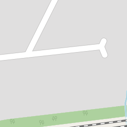
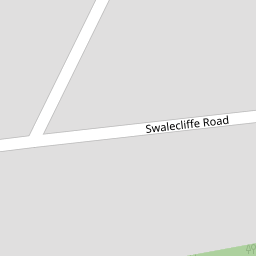

Leaflet © OpenStreetMap contributors
The heatmap indicates the level of crime in the area. The color of the heatmap indicates the crime severity and recency.
Metrics Year-on-Year
- Average area value
- 277,995.00 £Increased by 12.95 %
- Est sale value
- 159,643.00 £Decreased by 3.44 %
- Average area rental value
- 1,080.00 £/moDecreased by 3.91 %
- Est letting value
- 0.00 £/moDecreased by 100.00 %
- Est rental Yield
- 4.66 %Decreased by 14.96 %
- Crime Rate
- 6.00 %Unchanged by 0.00 %
from 246,113.00 £
from 165,322.00 £
from 1,124.00 £/mo
from 631.00 £/mo
from 5.48 %
from 6.00 %
Nearby Schools
| Name | Type | Ofsted | Distance |
|---|---|---|---|
| Swalecliffe Children'S Centre | Children's Centre Linked Site | 0.22 KM | |
| Swalecliffe Community Primary School | Foundation School | Good | 0.24 KM |
| St Mary'S Catholic Primary School, Whitstable | Academy Converter | Good | 2.48 KM |
| The Whitstable School | Academy Converter | 2.74 KM | |
| Westmeads Community Infant School | Community School | Outstanding | 3.45 KM |
Images
Nearby Streets
| Name | Average Price | Average Sqft | Distance |
|---|---|---|---|
| Palace Close | £ 0 | 0 | 0.00 KM |
| Newton Road | £ 499,950 | 0 | 0.00 KM |
| Harvey Drive | £ 450,000 | 0 | 0.00 KM |
| Nasella Gardens | £ 0 | 0 | 0.00 KM |
| Barley Drive | £ 0 | 0 | 0.00 KM |
Nearby Transport
| Name | NLC | TLC | Distance |
|---|---|---|---|
| Chestfield And Swalecliffe | 5200 | CSW | 0.69 KM |
| Whitstable | 5196 | WHI | 3.06 KM |
| Herne Bay | 5174 | HNB | 6.31 KM |
| Canterbury West | 5007 | CBW | 8.70 KM |
| Sturry | 5029 | STU | 9.53 KM |
Nearby Listings
| Address | Price | Type | Score | Distance |
|---|---|---|---|---|
| Kemp Road, Tankerton, Whitstable | £ 525,000 | BUY | 7 / 10 | 0.08 KM |
| Kemp Road, Tankerton, Whitstable | £ 449,950 | BUY | 7 / 10 | 0.09 KM |
| Swalecliffe Road, Whitstable | £ 350,000 | BUY | 6 / 10 | 0.11 KM |
| Elm Wood West, Whitstable | £ 375,000 | BUY | 7 / 10 | 0.20 KM |
| Elm Wood West, Whitstable | £ 460,000 | BUY | Unknown | 0.20 KM |
Nearby Properties
| Address | Price | Distance |
|---|---|---|
| 45 Burnan Road | £ 173,000 | 0.00 KM |
| 54 Burnan Road | £ 280,000 | 0.00 KM |
| 36 Burnan Road | £ 322,500 | 0.00 KM |
| 33 Burnan Road | £ 191,000 | 0.00 KM |
| 24 Burnan Road | £ 217,500 | 0.00 KM |